Chamkarmon District (Khan Châmkar Mon)
Chamkar Mon (ចំការមន, meaning 'Mulberry Farm') is the southernmost district in central Phnom Penh, Cambodia. The district has an area of 10.56 km2. As of the 2019 census, its population is 70,772.
Chamkar Mon was subdivided into 12 Sangkats and 95 Phums (villages).
Chamkar Mon was subdivided into 12 Sangkats and 95 Phums (villages).
Map - Chamkarmon District (Khan Châmkar Mon)
Map


Country - Khmer_Republic
 |
 |
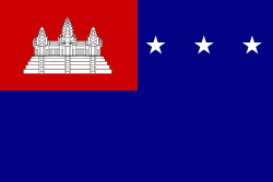
| Flag of Cambodia | |
The main cause of the coup was Norodom Sihanouk's tolerance of North Vietnamese military activity within Cambodia's borders; Vietnamese communist forces had gained de facto control over vast areas of eastern Cambodia as a result. Another important factor was the dire state of the Cambodian economy, an indirect result of Sihanouk's policies of pursuing neutrality.
Currency / Language
| ISO | Currency | Symbol | Significant figures |
|---|---|---|---|
| KHR | Cambodian riel | ៛ | 2 |
| ISO | Language |
|---|---|
| KM | Central Khmer language |
| EN | English language |
| FR | French language |